
2025 Year in Review

2025 was a fantastic year on All Things Missouri! The team added new tools, data, and reorganized the report structure to make your site experience even better. Let’s take a look back on the year.
Notable Tools
In 2025, we created tools and resources as a direct response to your needs. The Civic Muscle Index, developed in partnership with MU Extension Community Development leaders, explores the metrics and programs that drive community belonging, contribution, leadership, and vitality. The Missouri State House and Senate District Maps provide quick reference information on District boundaries, population statistics, and UM System impact. Further, the Broadband Needs Assessment and Broadband Resource Page provide relevant tools and starter maps to learn more about the state of internet connectivity and affordability in your county.
New and Updated Data
When it comes to data, the All Things Missouri team is constantly adding new and existing data. As of writing, over 30,900 layers are available to map in the Map Room from both state and national sources. Notable additions to the data repertoire in 2025 included air and drinking water quality, commuting information, data from the Missouri After School Network, and live data on wildlife diseases such as Bird Flu and Chronic Wasting Disease. See the graphics below to learn more about the most popular data with our visitors on All Things Missouri last year.
Report Changes
Finally, we spent a lot of time in 2025 reorganizing the reports available on All Things Missouri to make them as streamlined and useful as possible. We created the Social Determinants of Health Report, Housing Assessment, and Broadband Needs Assessment. We also reorganized the Youth and Education Assessment, Health and Human Sciences Assessment, Community Needs Assessment, and Business and Economy Assessment to better align with the data they contain. We hope the behind the scenes work on these reports saves you time by helping you find exactly what you need the first time.
Your Year on All Things Missouri
It wasn’t just the All Things Missouri team that had a big year. You spent an unprecedented amount of the time on the site creating custom Maps and Reports.
293,986 Maps Created in 2025
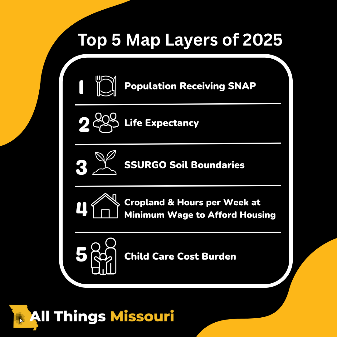
Lasr year, you created maps that dug into all aspects for your community—from food access to population statistics, and agricultural information to economic data. The top map layers accessed in 2025 included: Population Receiving SNAP, Life Expectancy, SSURGO Soil Boundaries, Cropland, Hours per Week at Minimum Wage to Afford Housing, and Child Care Cost Burden. These layers align with many of the stories that stayed at the front of the news cycle last year. If you haven’t yet, be sure to check out these map layers to learn more about your community.
20,857 Reports Created in 2025
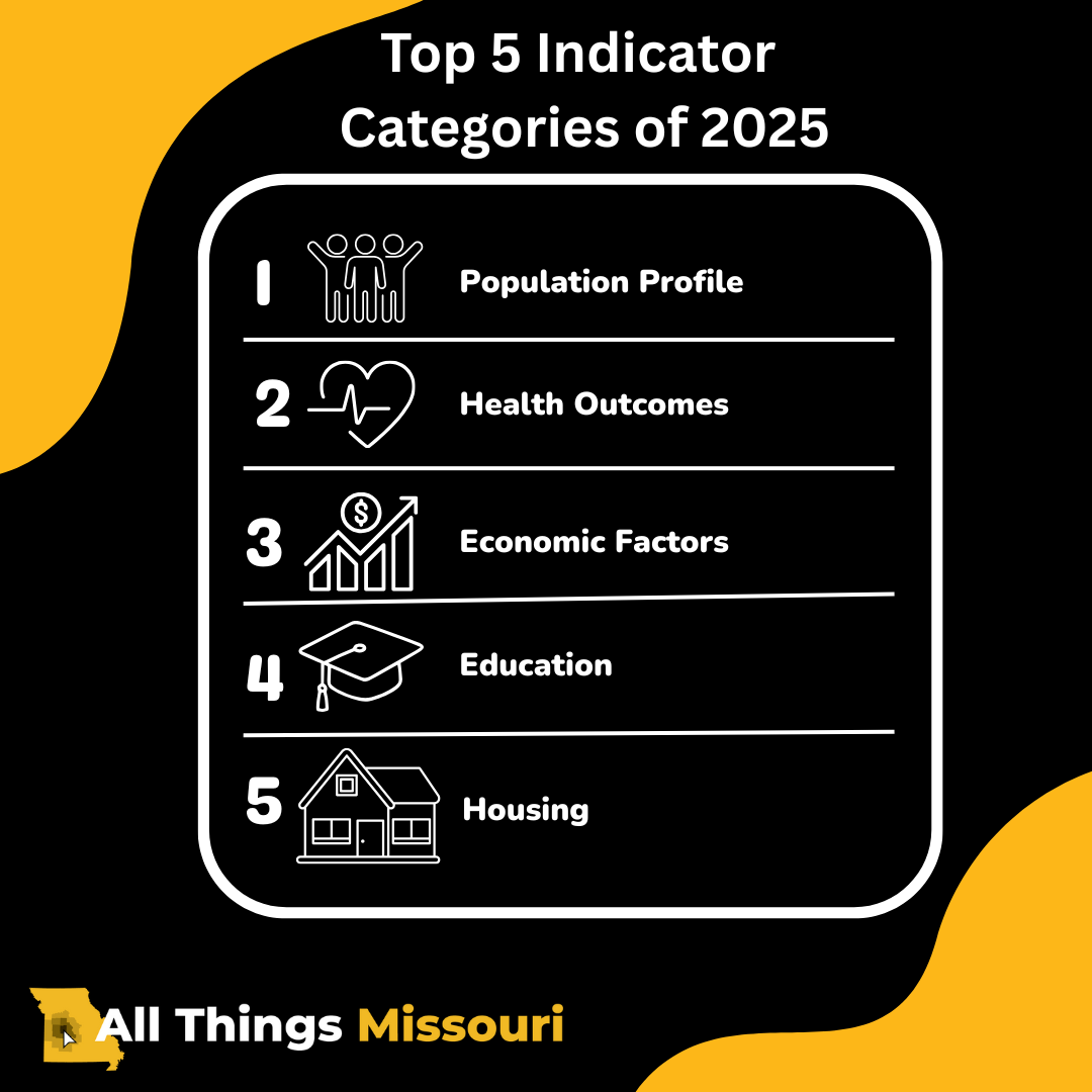
Along with being interested in a wide array of data to map, you included a variety of indicators in your 2025 reports. The top 5 indicator categories included: Population Profile, Health Outcomes, Economic Factors, Education, and Housing. Indicators that were exceptionally popular included Total Population Demographics, Poverty Rate, Educational Attainment, and Physical Inactivity. Whether you’re interested in the full suite of indicators, or looking to generate a more targeted needs assessment, be sure to explore our Report Gallery in 2026!
2025 was a big year for All Things Missouri, and that’s all because of you! Every piece of data we add, tool we build, and change we make is with your experience and impact in mind. We can’t wait to see what you do for the state of Missouri in 2026!